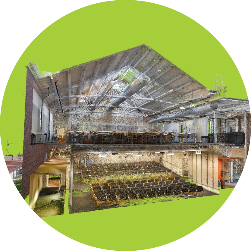
Whole-building reality capture leverages multiple technologies to create a highly accurate 3D representation of your building (sometimes called a Digital Twin). This scan is highly responsive to specific client needs—offering details like vertical/horizontal cross-sections and accurate dimensions of existing building and new construction elements.
Using a responsive method, combining mobile mapping, terrestrial laser scanning and drone photogrammetry, we’re able to capture your entire building from top to bottom, inside and outside. Combining these methods with on-site photos and systems information gives us a precise digital twin of your building.
Mobile Mapping
Mobile mapping is the fastest scanning method available today, adding the ability to take more frequent photos, giving your scan more context.
Terrestrial Laser Scanning
Terrestrial Laser Scanning is the most accurate scanning method available, giving you as close to 1-to-1 measurements as we can get today.
Drone Photogrammetry
Drones play a vital role in laser scanning, helping you monitor your construction progress or create a master site plan for your new development.
Digital Twins
A Digital Twin combines building scans, photos, and documents in one easy-to-access place to create an accurate digital replica of your building.
More accurate, more insightful as-built drawings
Traditional building surveys rely on professionals to take precise measurements and detailed notes to give context to each set of numbers. Instead of gathering measurements for each item in a space individually, laser scanning the space gathers all of the measurements at the same time, giving you a more comprehensive and accurate data set. Once the reality capture is complete, the resulting point cloud enables you to measure the building without needing multiple site visits.